We drove down from Auckland, parked up and headed across country. The path has been scoured out by rain and I’m glad it was dry when we did it. A sign warned that the three hour walk time could expand to five hours in poor weather.

From the first hut where we spent the night, the track follows the path of the famous Tongariro Crossing, one of the world’s best one day hikes. It gradually climbs up a valley of sharp black rock that was clearly lava relatively recently. Then the track climbs relentlessly to Tongariro’s South Crater, overlooked by the brooding presence of Ngauruhoe. The track crosses a lip of rock and abruptly you enter the South Crater. I imagine parts of Mars look like this.

To the right, Ngaurahoe has just, briefly, cleared its head of cloud. A trail can vaguely be seen winding its way up the tephra scree for those game enough to summit it. Scree is never an easy climb and it is a steep 2300 feet to the top.
It last erupted in 1977. It is described as a side vent to the lower, but once larger, Tongariro. And towards Tongariro the track now turns.

It is another steep climb to the highest point of the track above Red Crater, but before we reach it, there are views to take in. Pausing half way, you can look down on a rocky alpine desert. This is where we will be walking in the afternoon.

Turning to look back at the South Crater, people are dwarfed by its scale as they cross it.

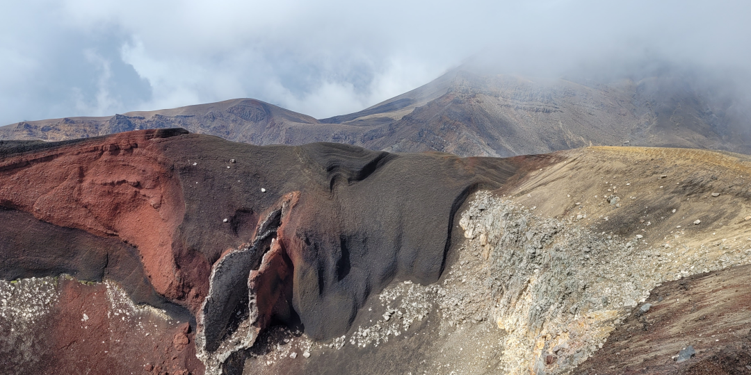
At the top of a steep section, some people pause for a drink and a snack. I push on for a few metres and stop on the edge of Red Crater and look into its organic looking rock formations. They are visible for a few minutes before the cloud sweeps in and it is gone. Tough luck, snackers! Unnervingly in the cold cloud, waves of warm air ride up out of the crater. They come from steaming vents out of sight below.

We descend through the cloud to the Emerald Lakes, glowing their eerie green even in the murk. Here we leave the Tongariro Crossing and descend a lava flow onto another plain. Huge black buttresses are behind us, the rocks are speckled with minerals, steam hisses out of the ground and a stream trickles beside the track.


Crossing the plain, we can look back to where we came from.

At our next hut, there is a waterfall, a view of the distant State Highway 1 and a view into tomorrow’s country.


There’s also a view back to the volcanoes. A line of rock crosses the plain. In the fading light it looks some ancient ruined wall built to keep out who knows what from the fire mountains behind.

The next day, we cross seemingly endless hills of gravel, enter a forest, like an oasis on one side of a valley with a stream running through it lined with flowering manuka, hebe and toetoe (NZ’s native pampas grass).


The third and final hut is also the newest. A short walk away, unencumbered by a pack, we visit a resurgence where a river emerges full formed and clear from underground, nurturing lush vegetation.
A dragonfly perches on a hat and then a leg.
The next day, low cloud hangs across the land. The hills are more rounded and they are covered in tussock and stunted little flowering plants.
Ngaurahoe reveals itself by the seething capping cloud which obscures its face, but not its shape.
As we finish the walk, it starts to rain. Four hours later, we arrive on Auckland’s outskirts. We hit traffic in heavy rain that will cancel an Elton John concert and cause major flooding and landslips across the city. The power of nature is manifesting itself in a quite different way to what we’d witnessed in the mountains.


